Data Update
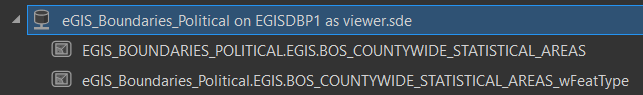
CSA boundaries in the table eGIS_Boundaries_Political.EGIS.BOS_COUNTYWIDE_STATISTICAL_AREAS have been updated to reflect the recent Santa Clarita annexation. Please see the feature class metadata for a description of the updates and reach out to eGIS with any questions. Similarly, the associated REST endpoint and Open Data layer reflect the new boundary as well.
Schema Change
Also, as discussed in the last Data Committee meeting, there is a new CSA table added to the repository: eGIS_Boundaries_Political.EGIS.BOS_COUNTYWIDE_STATISTICAL_AREAS_wFeatType. This layer has updated schema to include the new feature type (“FEAT_TYPE”) field, which can be one of land, water, breakwater, or pier (consistent with the City Boundaries layer).
Our plan is to replace the existing CSA table with the new schema table (_wFeatType) after a transition period. Over the next few weeks, please republish services to the new layer and test out maps or calculations that are based on the boundaries. Note with the schema change that there are multiple rows in the table for some CSAs (one for each feature type), which may have an impact on calculated statistics or visualizations.
Schedule
- 1/3/2023 – New schema table added to repository: BOS_COUNTYWIDE_STATISTICAL_AREAS_wFeatType
- 1/20/2023 – Schema changes will apply to existing table: BOS_COUNTYWIDE_STATISTICAL_AREAS
- 2/3/2023 – Drop the new schema table: BOS_COUNTYWIDE_STATISTICAL_AREAS_wFeatType
** Timing is flexible, so please reach out with any concerns.
Hello all,
Update that schema changes to the table BOS_COUNTYWIDE_STATISTICAL_AREAS (adding featType field) will take place after 5pm tonight 1/24/23. Apologies for the delay – please reach out with any questions or concerns.
Thank you,
Rob Graham